Kala'mas Spring 2021 Article - Modernized Land Use Plan
The following article about the Gwa'ni Project was shared in the spring 2021 issue of Kala'mas, 'Namgis First Nation's community newsletter.
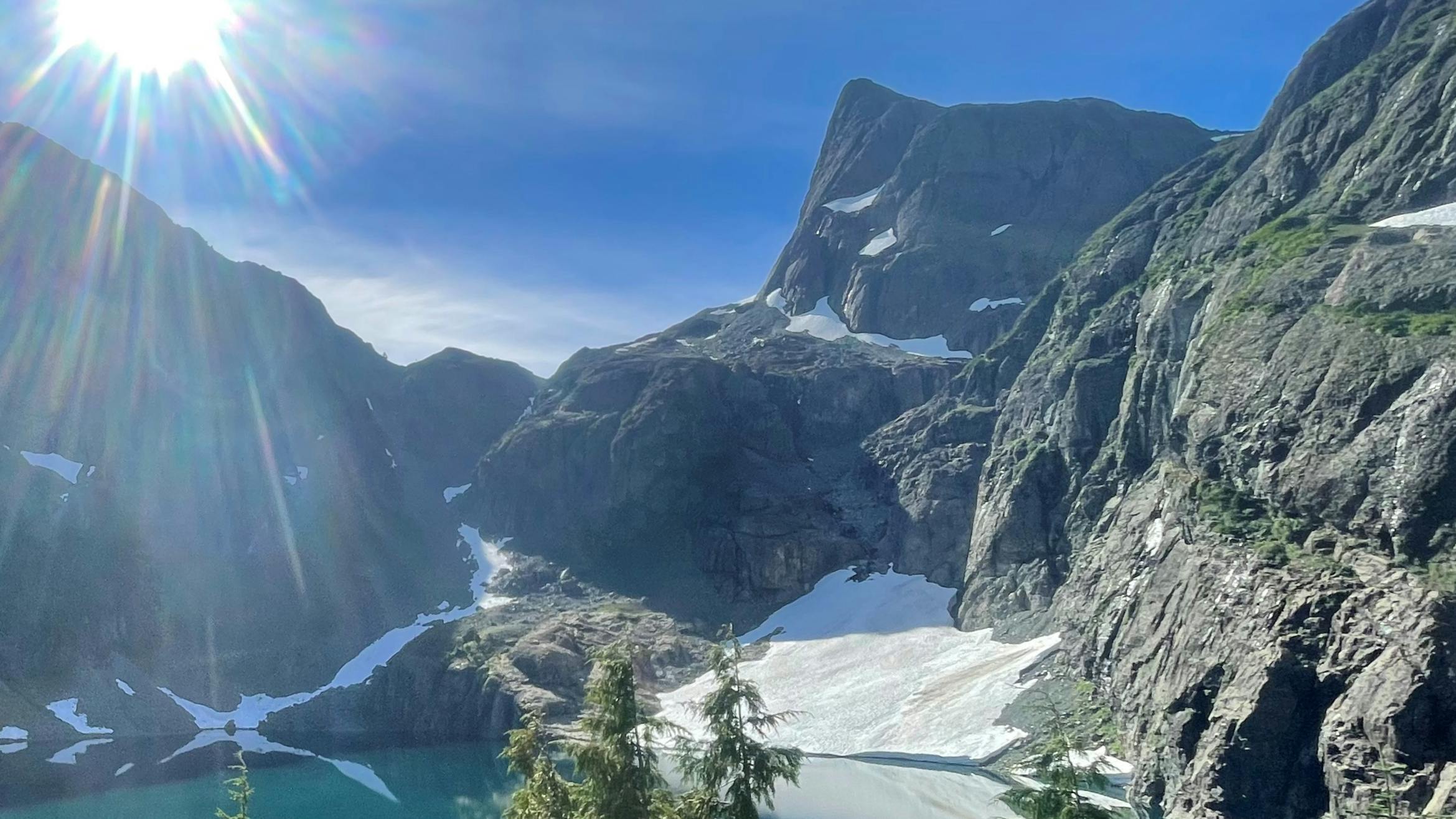
‘Namgis First Nation is partnering with the B.C. government to develop a modernized land-use plan for the majority of the Nimpkish Valley. This process will take several years to complete and is being called the Gwa’ni Project. The memorandum of understanding will allow us to share recommendations with the Province on how our resources and lands should be managed for future generations. The final land-use plan will cover lands from the mouth of the Nimpkish River to the Vernon Lake watershed. It will guide what can happen on lands, rivers, lakes, watersheds, and forests in the planning area. This announcement marks the beginning of this project and no decisions about land use in the territory have been made. We will continue to share information on the project as it progresses, and all members will have an opportunity to engage in the process so that the recommendations reflect our Nation’s values and interests.
FAQ
What is the Gwa’ni Project ?
The ‘Namgis First Nation is partnering with the B.C. government to modernize land use planning in the Nimpkish Valley. This project will take several years to complete. It will allow ‘Namgis to share recommendations with the Province on how our resources and lands should be managed for future generations.
We are optimistic about this opportunity to work with B.C. in this collaborative way. It will be a big step towards ‘Namgis exercising our inherent rights over our territories.
What area will the land-use plan cover?
The plan will cover lands from the from the mouth of the Nimpkish River to the Vernon Lake watershed.
What will the land-use plan be about?
The Gwa’ni land-use plan will guide what can happen on lands, rivers, lakes, watersheds, and forests in the planning area. The plan will also detail areas that will be protected, and how.
A simple way of thinking about a land-use plan is zoning – the plan will tell people, communities, and industries how to manage and protect resources and activities like:
- Forests
- Rivers
- Lakes
- Watersheds
- Fish and wildlife
- Caves/karst
- Medicine and bark harvesting
- Important cultural sites
- Tourism
- Recreation
- Mining
- Forestry
How long will this process take?
Land-use planning takes several years to complete. There are five steps in the B.C. land-use planning process and the Gwa’ni project is entering the second step. The five steps are called:
- Pre-planning
- Plan initiation
- Plan development
- Plan evaluation and approval
- Implementation and monitoring
Why is this important to ‘Namgis?
Participating in this process is a step towards restoring our voice and authority over long-term decisions made on behalf of our lands and territories.
During the comprehensive community planning process, members expressed the importance of developing a territorial plan and ensuring that ‘Namgis is making decisions about how land is used within our territory. This collaboration with the B.C. government is one of the ways we are fulfilling those priorities.
We are hopeful that this new partnership with the Province will give us a strong voice to determine how lands, rivers, lakes, watersheds, and forests in the Gwa’ni project area can be used and protected.
How can I get involved?
We will share information about the project as it moves forward. All members will have a chance to share their input during different stages of the project.
